On The Wings Of God
September 18, 1966
The sound of
the rain on the roof awakened me and I groped for the clock to see what time it
was. It was nine-thirty. I had overslept again. As always, I skipped breakfast
– the sight of food is repulsive to me so soon after getting up. I quickly
stuffed my bags in the car and headed for the airport.
“Rain diminishing by afternoon…” said the
radio announcer. The temperature was 71 degrees…a normal fall day in
Mississippi, but wouldn’t you know it would rain the day I wanted to fly.
“It’s all serviced and ready to go, Lew,”
said Mr. Hooper as I bounded in the door of the operations office to keep from
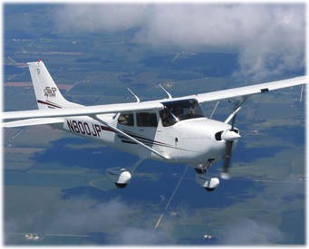
getting wet. The rented Cessna 172 was sitting on the ramp looking very sleek
and shiny in the rain. “Great. Now turn
that rain off so I can get started.” Hooper made some remark about the
clouds being my problem, not the rain. I had to agree.
The office
teletype clacked out a few weather sequences. None of them covered the final
portions of my flight plan; but the weather gradually improved to the north of
the field, so if I could just get out of here, I had it made.
Lowndes
County Airport was an uncontrolled field. No weather station or Flight Service.
The teletype and a telephone were its only links to the aviation world beyond.
I had learned to fly here and had just passed my private pilot check just two
days before. Now I could go anywhere. It was just like getting a driver’s
license, or so I thought. It all seemed simple on paper.
My flight
plan was to fly north from Lowndes County Airport to Columbus, Ohio, with a
refueling stop in Bowling Green, KY. I had broken up my six-hour flight plan
into two, three-hour legs, allowing myself a day in Columbus to plan the
subsequent legs to Washington D.C. If
I could get to D.C. on Tuesday, I’d have time to prepare for my wedding on Wednesday.
My well-thought-out plans were slowly dissolving in the steady pitter-patter of
rain.
The rain
changed to a drizzle around noon. “Looks
like you got a thousand feet if you want to give her a try,” suggested Mr.
Hooper. I eagerly agreed. “Yeah, it looks
good,” I said, not having the slightest idea what one thousand feet
straight up looked like.
Mr. Hooper
helped me load the plane and, after a quick preflight, I taxied out for a look.
Ha, who was I fooling? I was going, period. It might look rather nasty now, but
the weather would surely improve as I flew north. Heading north, my convictions
were confirmed. The ceiling slowly gave way and the rain gradually stopped. By
the time I crossed into Tennessee, my Cessna was droning along in the clear,
and I was humming the Wedding March and making big plans. Bowling Green was
below me before I knew it, and I was on my flight plan to a tee.
“Fill ‘er up,”
I said and wandered off to the snack bar for a little servicing of my own.
Later, I made a weather check; conditions at Columbus, Ohio were not good –
cold and rainy with a ceiling of 1,200 feet. I wasn’t too concerned since I had
just flown through worse. No sweat! I called my folks and told them to meet me
at the Columbus Airport in three hours. I would have the evening and most of
the next day to spend with them. After I hung up, it occurred to me that by the
time I got there it would be close to seven. I wondered what time the sun set
in Columbus, but the thought passed quickly.
By 4 p.m. the
Bowling Green Airport was below and behind. If I maintained my airspeed a
little higher, I could reduce my ETA and still have gas to spare. I pinched the
throttle forward and adjusted the mixture. A broken cloud deck at 4,000 feet
caught my eye, but I didn’t think much about it. To the north the weather
looked bad, but the weatherman had said 1,200 feet would be the worst, so I
pressed on.
As the clouds
descended, so did I. I liked being low, and the Kentucky landscape was a
fascinating collage of rivers, streams and farms. I couldn’t get over the
excitement of actually flying alone from state to state. It was power and
freedom in one beautiful package.
My excitement
slowly changed to concern as I spotted one or two of the higher hills poking up
into the clouds. I began map reading and located my exact position. I was over
Fort Knox, right on flight plan. Then my heart skipped a beat – I saw that Fort
Knox was a prohibited area for flying, and I was right in the middle of it. I
had a crazy thought that I’d be shot down – or whatever they do to aircraft
flying through prohibited areas. It was pure agony until I passed beyond it.
I was
receiving the Louisville VOR (VHF Omnidirectional Range) earlier than planned,
but as I descended to stay beneath the cloud cover, the VOR broke lock. Now it
was low-level navigation or nothing. As more and more hilltops disappeared into
what had suddenly become an overcast, I strained to locate powerlines and
towers ahead. It was now painfully clear that if the present trend of clouds
meeting ground continued, I could not continue the flight. But the thought of
spending a night in Louisville motivated me to keep going. Then the Ohio River Valley
appeared ahead, and I knew it would lead me to Cincinnati. I headed for it.
As I flew along
in the Ohio River Valley and between its wonderfully high and wide banks, I
marveled at how well my plan seemed to be working. But soon I found myself
trapped between the river banks and a ceiling of clouds a few hundred feet
above me. After a few nerve-shattering squeezes between the tops of bridges and
the bottom of the clouds, I had to go in and out of the clouds to clear
bridges. About this time, I realized that if my meandering course along the
Ohio River were straightened out, I would probably have reached Columbus by
now. I was way behind my flight plan, and something had to be done. I began a
300 feet-per-minute climb and the engine hummed reassuringly. My five hours of
dual instrument instruction were sure paying dividends as I was now totally
consumed by the clouds. Never mind the fact I was on a VFR (Visual Flight
Rules) flight plan.
I was
maintaining a heading of approximately 70 degrees, which should take me to
Cincinnati from the point at which I left the river. It was raining now,
although not heavily, and I continued to climb toward what I hoped would be a
sunny sky. While passing through about 7,000 feet, I realized that my VOR
should be locked onto something, but it wasn’t. Nothing would come in. A glance
at my map told me the Cincinnati VOR should be within range and that my heading
was good.
Then I
noticed that my gyro compass was reading almost 35 degrees off the magnetic
compass heading. My instrument flying suddenly went berserk as I quickly resent
the compass and realized that I was lost. After regaining control of the plane,
I took up a heading of 90 degrees in hopes of correcting back to course.
I was now at
10,000 feet, but nothing but more rain and clouds. Suddenly the airspeed
indicator dropped to zero. Ice!! I
quickly turned on the carburetor heat and pitot heat and started what I thought
was a rate of descent, using the attitude indicator and the sound of the wind
on the airframe.
I had read
many times that, during an emergency, a pilot should keep calm. I decided to
try it, and for about three minutes I sat back and relaxed as much as I could,
knowing that I was lost in the clouds with no airspeed indicator or navigation
equipment. When I had collected my thoughts, I checked the chart for terrain
elevation in the possible area of my aircraft. I decided to descend no lower
than 1,800 feet MSL.
By the time I
reached 1,800 feet, I had my airspeed indicator back but was still in the
weather. I wondered how accurate my altimeter setting was. I hadn’t reset it
since leaving Bowling Green. I checked Cincinnati VOR and hoped for a weather
broadcast. I could remember what time the weather was broadcast.
All of a
sudden, there it was; a hole in the clouds that I had been praying for was
right below me. It was a small hole, but I thought I could make it. By the
grace of God, I didn’t get disoriented in my steep spiral down through the
opening. As I broke out, freeway signs flashed below. I could recognize the
makes of cars on the road and estimated my altitude at 200 feet. I had driven
the route a number of times and recognized it as the outer belt around
Cincinnati.
It was dark
as I followed the interstate. My ETA for Columbus had passed, and I still had
40 minutes of flying left – according to the mileage signs on the freeway. My
sectional showed two arrows on the southwest side of Columbus with the name
Taylor beside them. I decided that it must be an intersection. I called
Columbus Airport approach when I reached the intersection, but the controller
had never heard of it. I told him it was located 30 miles southwest of Appleton
VOR. He asked me to call over Columbus.
“Columbus Approach Control, this is
Cessna 7080 Tango.”
“7080 Tango, go ahead.”
“Over Columbus, VFR, for landing.”
There was a
pause.
“Cessna 7080 Tango, did you say VFR?”
“Roger”
“7080 Tango, the airport is about to
close for all traffic due to weather. Stand by.”
I stood by,
but soon found myself right on top of the city trying to avoid the tops of
buildings that were jutting into the clouds.
“7080 Tango, cleared to land on runway
zero nine. Can you find the field?”
“Roger, I’m familiar with the area.”
“Call field in sight.”
I followed
the streets leading to the airport and felt reassured because I was in familiar
territory. The runway strobe lights came into view just in time for me to
zigzag and land. It was all over.
I turned off the runway and was cleared by ground control to the general aviation ramp. I said “Roger”, not having the slightest idea of where the general aviation ramp was. A follow-me truck intercepted me. As I followed the signals and maneuvered for a parking spot, my engine suddenly sputtered and died. Looking around the cockpit, I soon found out why. The fuel tank selector was on left tank – the same position it had been in when I took off. And that tank was now empty.
|